How to riding to Ha Giang Loop by motorbike?
Your youth should come to Ha Giang once, because Ha Giang is beautiful not only at the destination but also on the roads and on the journey we go through.
Ha Giang day back
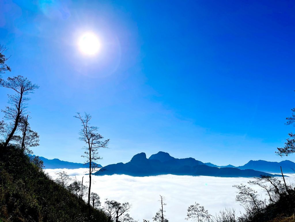
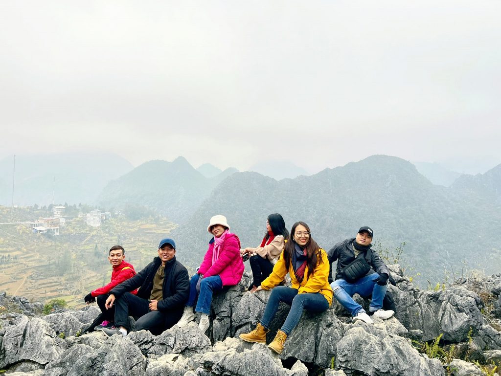
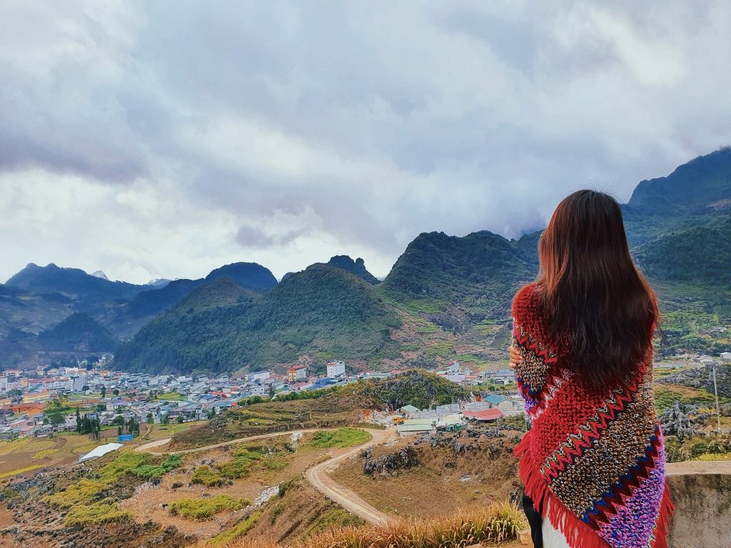
– Ha Giang nearly ten years ago, is a land located at the beginning of the country, the area is still wild and little known, more than 90% of the population are ethnic minorities residing in the hills and valleys. and villages (H’Mong, Tay, Dao, Lo Lo, Giay, Pu Peo). Dong Van geological plateau is the most beautiful and remote place of Ha Giang, recognized by UNESCO as one of 77 important archaeological and cultural heritage sites; This place is formed from karst that is nearly 400 million years old. To reach Dong Van or Meo Vac is still a conquest on dangerous passes and rough gravel roads that people who love traveling find very “amazing and “exciting”. And it is still a land untouched by the tourism industry.
– Ha Giang nowaday: has developed dramatically, the local government has advocated investment in roads, cars run smoothly (except for the section from Meo Vac town to Du Gia and Du Gia to Ha Giang city, which has not been built yet). completed road). Homestays appear in famous tourist areas. Even when people go to visit the Nho Que River, there is a car that takes them to the boat dock instead of having to spend all day hard “crawling and climbing” to find the way down. Thanks to the development of tourism, more people come to Ha Giang, the majestic beauty of the rocky mountain plateau is known not only to Vietnamese people but also to international friends. Ha Giang has now developed tourism, helping people People’s lives are improved.

1. Where is HA GIANG?
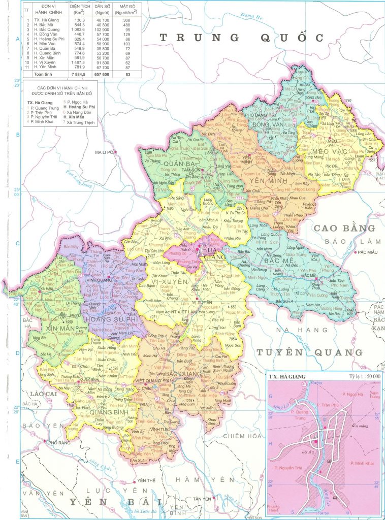
Ha Giang is a mountainous province in the Northeast of Vietnam. The east borders Cao Bang province. The west borders Lao Cai province. The south borders Tuyen Quang province and Yen Bai province. To the north it borders Yunnan province and Guangxi autonomous region of China. And it belongs to the Northeast mountainous region with other provinces such as: Bac Kan, Lang Son, Tuyen Quang, Thai Nguyen, Phu Tho, Bac Giang, Quang Ninh. Has an area of about 8000 km2. And is home to 22 ethnic minorities in our country with diverse cultures and customs.
List of districts and towns of Ha Giang province: Bac Me district, Bac Quang district, Dong Van district, Hoang Su Phi district, Meo Vac district, Quan Ba district, Quang Binh district, Vi Xuyen district, Xin Man district, Yen Minh district . Ha Giang city is the only city of Ha Giang province.
In this article we will share traveling from Ha Giang city is towards the North of Ha Giang
2. Should go to Ha Giang at what time?
2. WHEN SHOULD YOU GO TO HA GIANG?
Ha Giang is beautiful in every season, due to its warm subtropical climate, but due to its high mountainous terrain, Ha Giang’s climate is more temperate.
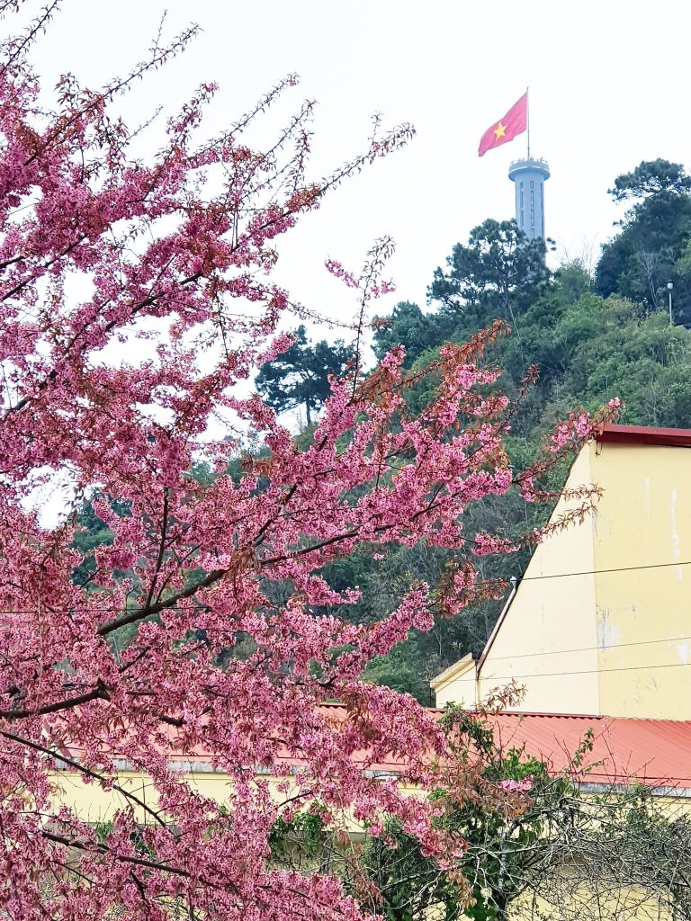
– January, February (lunar calendar): Spring, the season of peach and plum blossoms.
– March: bombax ceiba flowers everywhere – In the remaining months, Ha Giang is also very beautiful but it often rains, sometimes there are landslides so it is quite dangerous
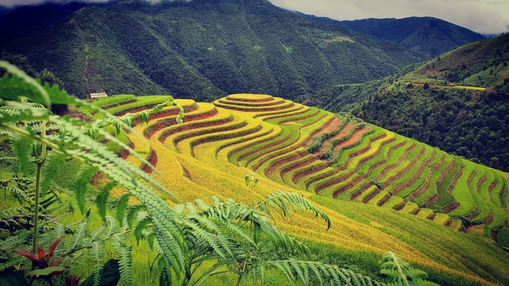
-August, September: Ha Giang is “dyed” yellow by ripe golden terraced rice fields. The most beautiful place is in Hoang Su Phi.
– October to December: Buckwheat flowers bloom.
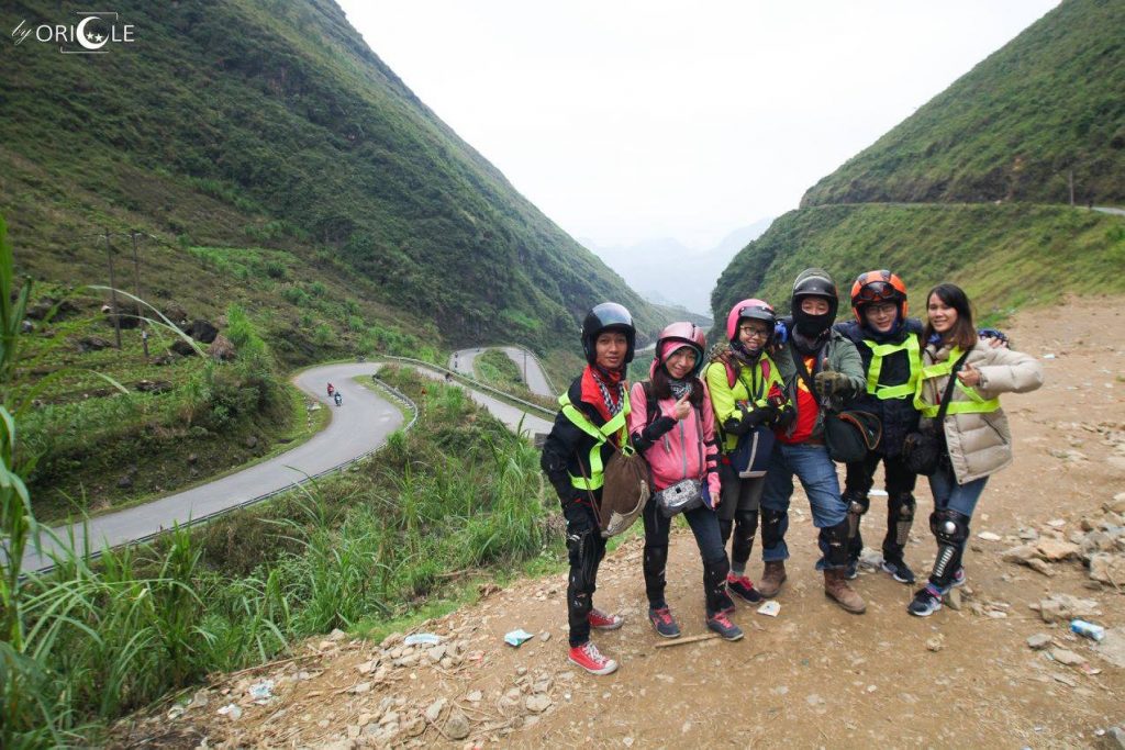
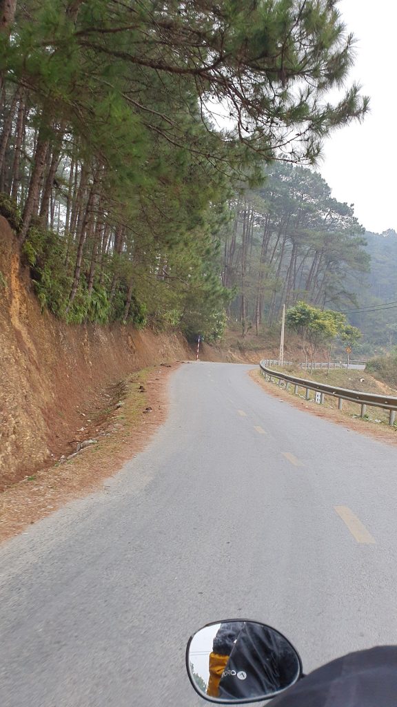
3. MEANS OF TRANSPORTATION? -✈️ Airplane: for those of you from Ho Chi Minh City or other regions flying to Hanoi to conveniently catch a bus to Ha Giang city. -🛵 Motorbike: use a sleeper bus from Hanoi to Ha Giang City and then rent a motorbike to travel everywhere. – 🚗 Car: anyone with a driver’s license can rent a car to drive around, the mountain pass is easy to go. Going by car saves time and health, but it’s not as great as a motorbike and it’s easy to get motion sickness due to the winding mountain roads.
4. ACOMMODATION (WHERE TO STAY?)
Depending on the schedule and route, people book a suitable homestay/hotel
– Ha Giang city: very developed, so there are many hotels and homestays, feel free to book on agoda.
– Quan Ba – Yen Minh – Du Gia: Homestay Association, Cheers Du Gia Homestay
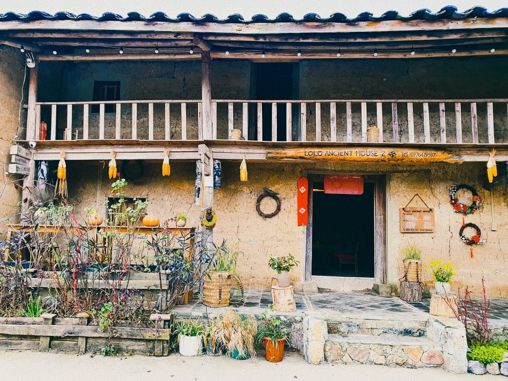
– Dong Van – Lo Lo Chai: Lolo Ancient House (Recommend for everyone to stay here)
– Meo Vac: Thao Gia Homestay (a bit far from the center but the view of Meo Vac town is very beautiful and also convenient to Du Gia)
– Pho Cao…
Schedule review: 🧚🧚🧚 enough routes and experiences in all weathers in Ha Giang spring
– Day 1: HCM City – Hanoi – Ha Giang City:
Travel by plane at 6pm to Noi Bai airport (Hanoi), then to Ha Giang city by Bang Phan bus (choose sleeper or double cabin depending on flight time and ask the bus company for advice). Choose this time frame to save time and is suitable for office workers. => Take a nap at 5am and arrive in Ha Giang city.
– Day 2: Ha Giang city-Quan Ba-Yen Minh town-Pao’s house-Meo King’s mansion-Lo Lo Chai village:
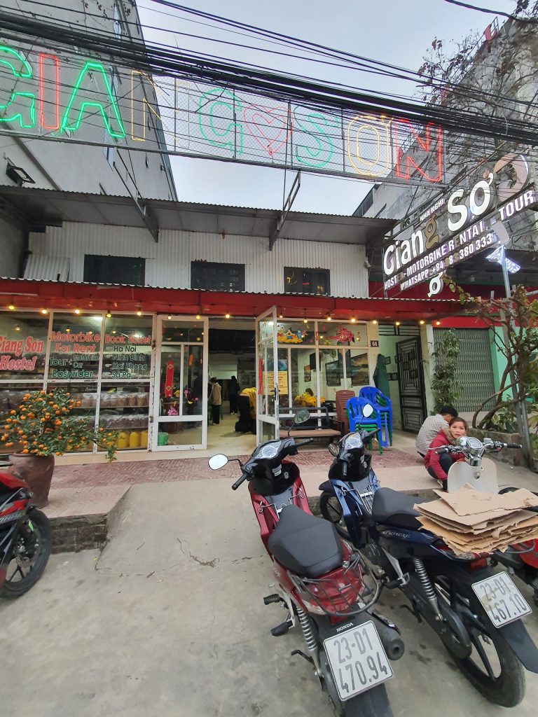
+ At 5:00 a.m., the bus arrives in Ha Giang city. I rent a motorbike at Giang Son motorbike shop. It’s a thoughtful motorbike rental, and also has a place to sleep and personal hygiene for those who arrive too early.
+7:30 am: go have breakfast with bun cha at 87 Le Quy Don Street, Nguyen Trai Ward, Ha Giang City (near milestone 0) which is delicious, cheap, and filling.
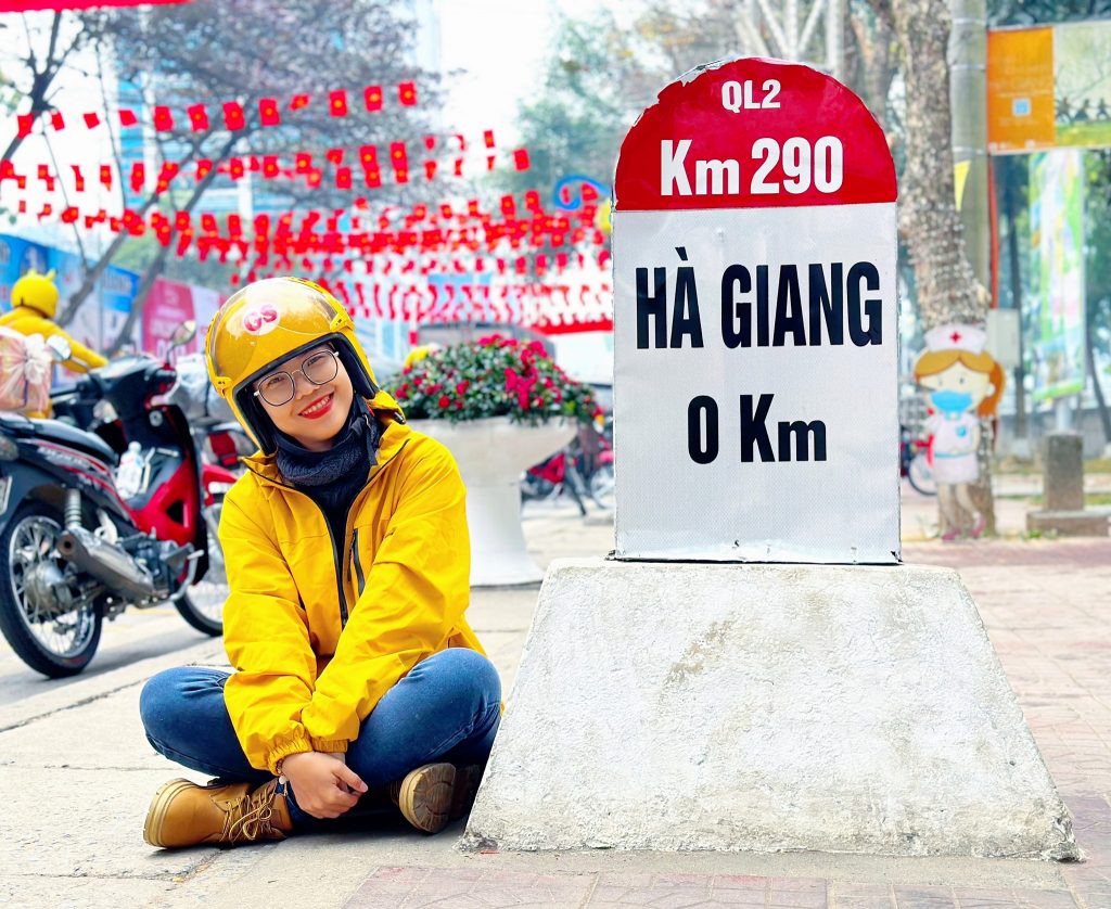
+8am: check in at milestone 0, drink coffee
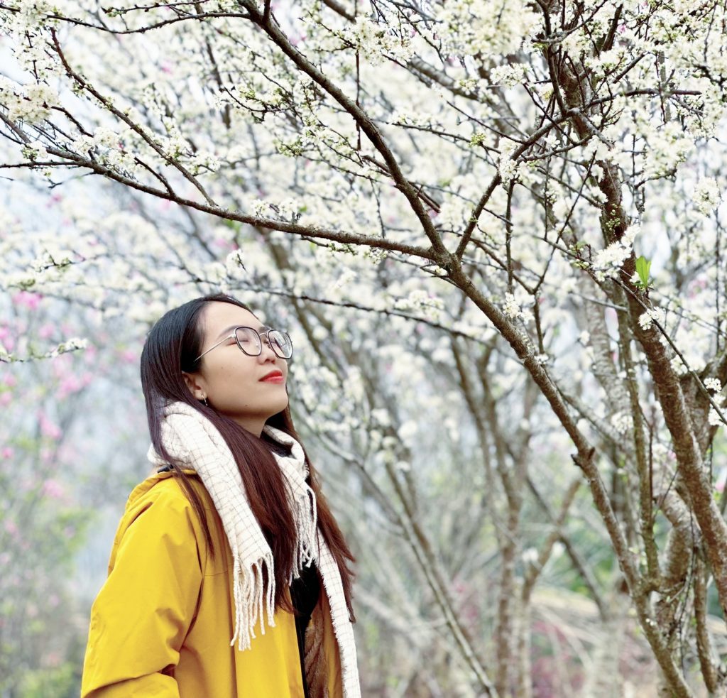
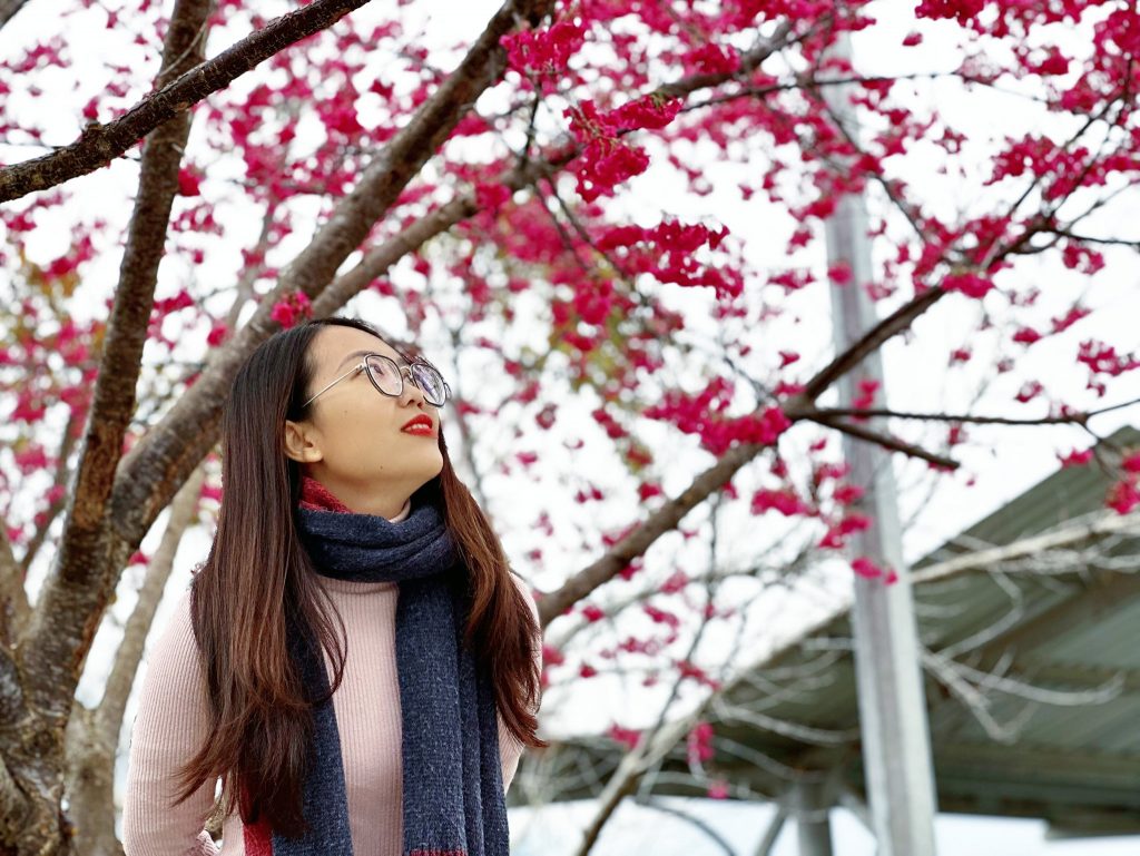
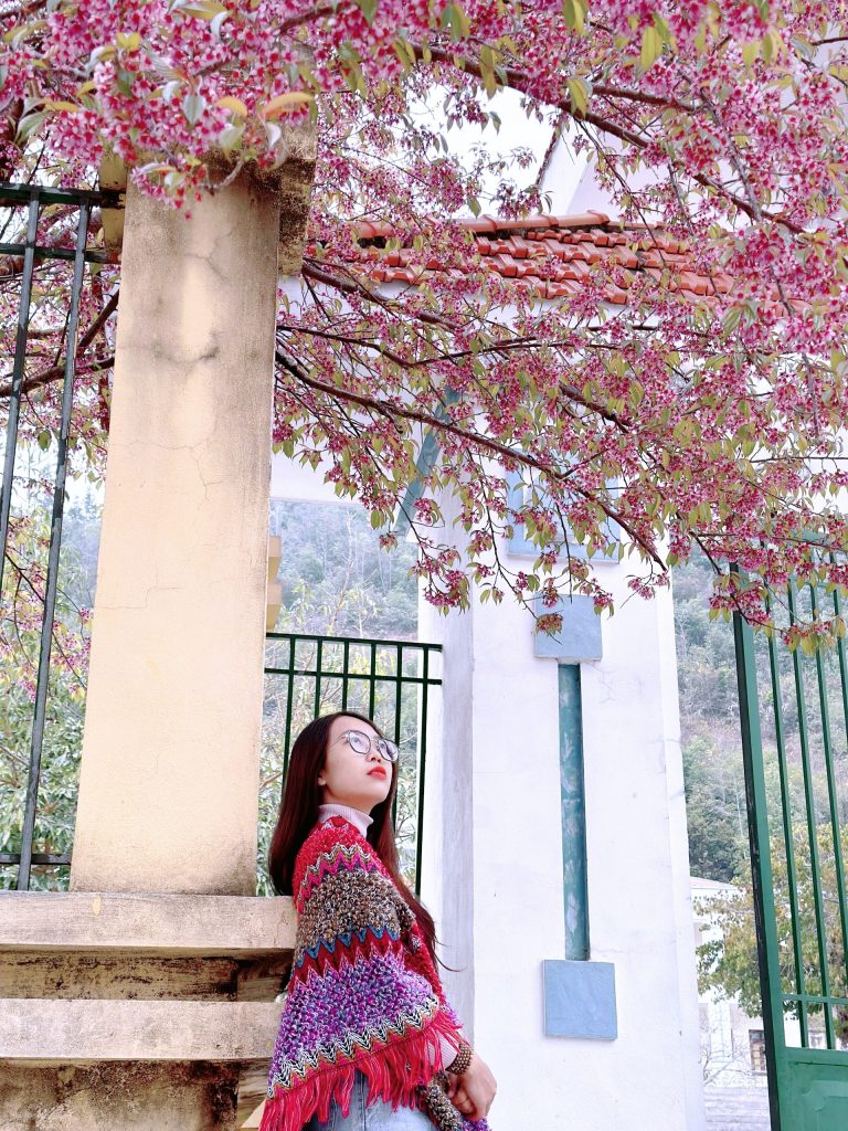
+9:00 am: move to Quan Ba. On the way to Quan Ba, we passed by a few cherry blossom gardens of local people. The flowers bloomed brilliantly, so we stopped in to take photos (ticket 10,000 VND/person).
Quan Ba Twin Mountains, also known by other names, Twin Mountains or Fairy Breast Mountains, were formed 1.6 million to 2 million years ago. The mountain has a round shape, as full as the chest of a sleeping fairy. So almost everyone who comes to Ha Giang checks in with this natural masterpiece
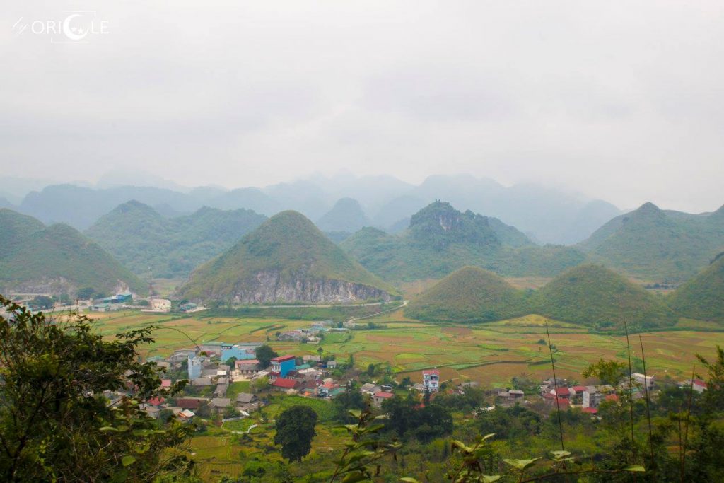
‘Legend of the Fairy Breast Mountains – The Twin Mountains, often referred to as the Fairy Breast Mountains, are steeped in a local Hmong legend. According to the tale, a skillful Hmong man’s enchanting whistle captured the heart of a fairy who descended from the skies to be with him. However, the Jade Emperor discovered her absence and reclaimed her, yet she had already given birth to a child from the Hmong man. To provide sustenance for her offspring, she left behind her breast, which eventually evolved into the twin mountains that we see today.
People here also believe that thanks to the fairy’s milk, the nature here is so rich. Her tears turned into a lyrical Mien River.”
+12:00 to Yen Minh: From Quan Ba to Yen Minh, you will pass through Yen Minh pine forest. If anyone is interested, you can stop by to take photos. Then go straight to Yen Minh town center and have lunch at Phong Van Quan on Tran Hung Dao street (delicious, nutritious, cheap, the owner is very nice and friendly)
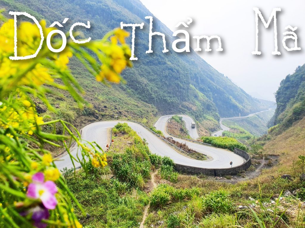
+1:00 pm: continue moving to Tham Ma slope. Stopped here for about 30 minutes to take photos, now people have built a place to park motorbikes and an embankment to take photos, including some street food hawkers
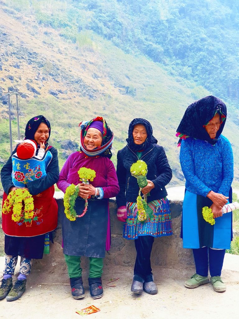
Spontaneous smiles, colorful colors, languages I couldn’t understand but I naturally smiled along with them.
– Tham Ma Slope-
Tham Ma Slope is literally understood as the slope used to evaluate horse power. Legend has it that in the past, on this slope, people used horses to carry goods from the bottom of the slope. Any horse that reached the top of the slope and was still healthy was a good horse and would be kept and raised by the people. Any horse that goes all the way uphill but is weak and can’t breathe will have a tray of Thang Co waiting in the highland markets. 😂😂😂 Today this slope is no longer used as a place to evaluate horse power, but to evaluate motorbike drivers when going up to Dong Van Stone Plateau.
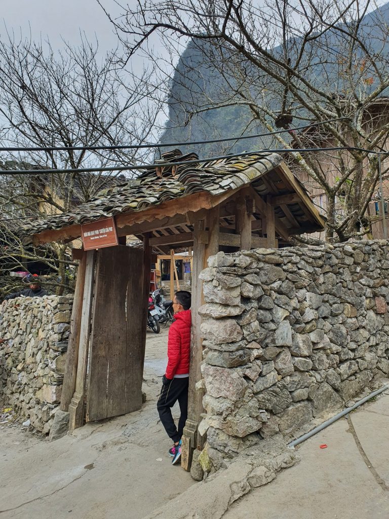
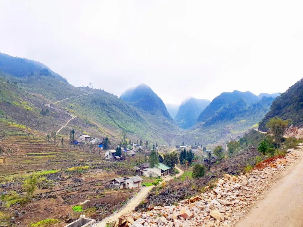
+ 2:30 a.m. Arrive at Sung La valley, visit the Film Studio “Pao’s story”, a convenient stop for parking and walking around. Entrance fee is 10,000 VND/person, taking photos with mustard flowers or buckwheat flowers is 10,000 VND/person, going to the restroom is 5,000 VND/person (note, don’t go to the area right next to Pao’s house, because it’s quite dirty, so go near gateway)
Sung La Valley is known as the most beautiful valley in the Dong Van stone plateau, Ha Giang province. Located on Highway 4C connecting the towns of Ha Giang and Sung provinces, just over 20km from Dong Van district, it is known by many nicknames such as “oasis”, “valley where rocks bloom” or “Bright and charming flowers of the rocky plateau”.
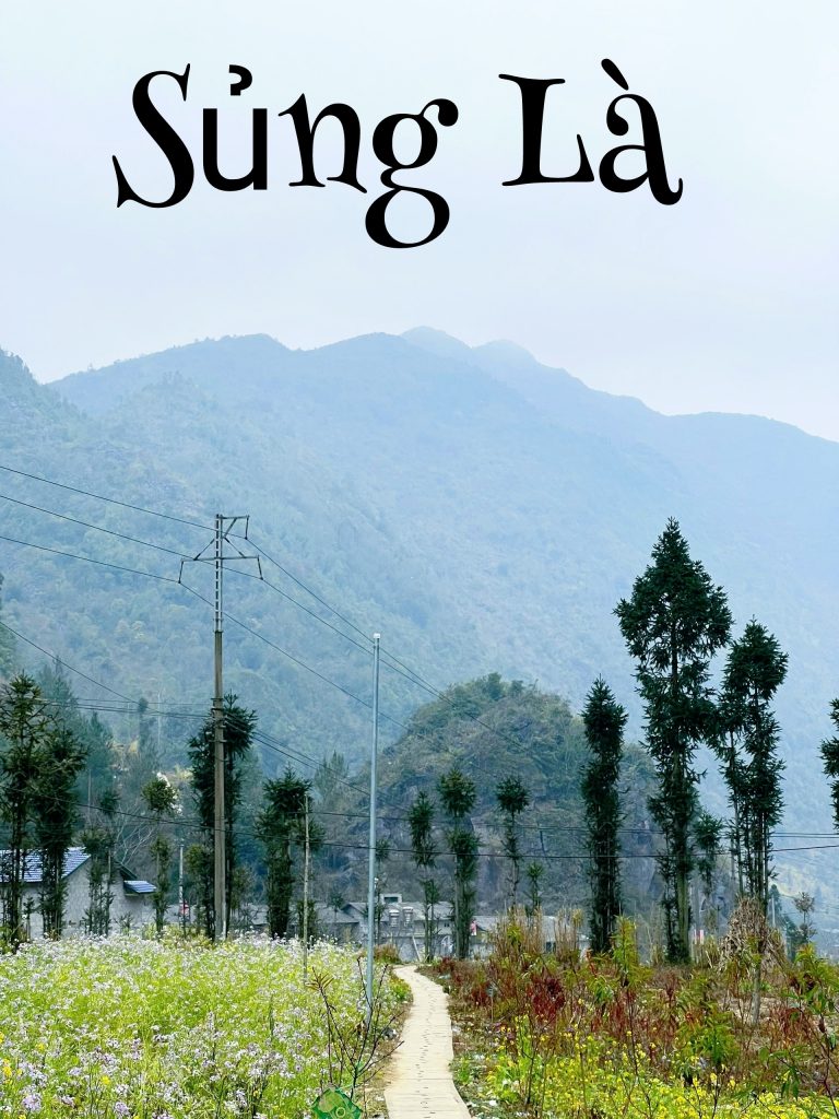
Formed on the precarious terrain of treacherous cat-ear rocks, but with the strong vitality and unyielding will of the flower buds, they have risen, giving the valley a sweet and enchanting landscape. Currently, Sung La valley is considered a famous tourist destination of Ha Giang not only for Vietnamese but also foreign tourists. Above all, with the appearance in the movie “Pao’s Story”, Sung La valley became more and more famous and loved by many people.
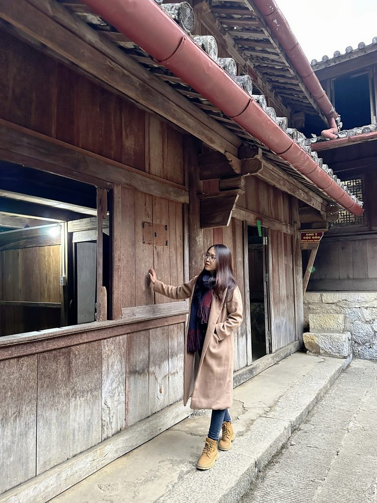
Pao’s house is in Sung La commune, Dong Van district, Ha Giang. After the movie of the same name, this place became an attractive tourist destination that anyone going to Ha Giang wants to visit. To get to this house, visitors will have to travel about 20 kilometers from Dong Van district. Sung La is located right on National Highway 4C connecting towns in Ha Giang
This house is built very rustically, with a front yard and fence made of stone and extremely beautiful yin and yang tiles. This place also grows plum and peach trees, so at the beginning of the year you will see brilliant flowers in front of your house
What you need when coming to Sung La valley is a beautiful soul and a phone or camera with enough battery capacity for you to take great photos.
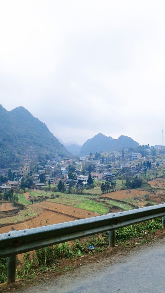
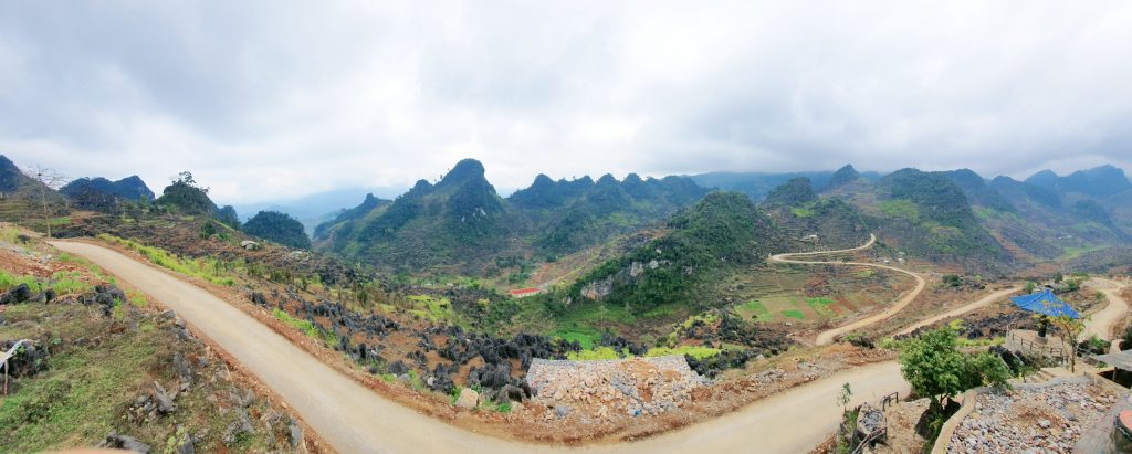
+ 4pm: visit Dong Van Stone Plateau, check in and take photos here for about 30 minutes Dong Van Stone Plateau is located in all 4 districts of Ha Giang province: Dong Van, Yen Minh, Quan Ba and Meo Vac with an area of nearly 2500km2. This is a rugged area of rocky mountains shaped like gray cat ears, looking very mysterious stacked on top of each other. The limestone mountains here have an average altitude of more than 1000m above sea level.
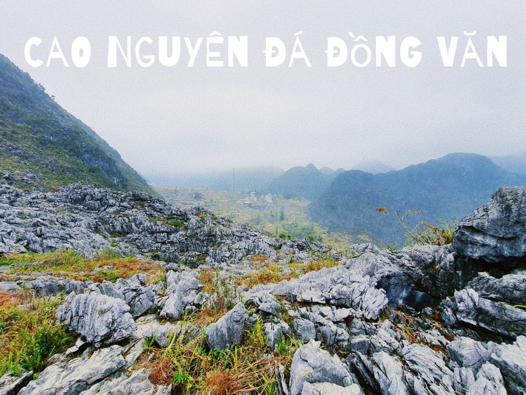
UNESCO Global Geopark: Dong Van Karst Plateau with over 70% of exposed limestone area. “Tsi muaj lub roob siab dua koj lub hauv caug” means “There is no mountain higher than the knee” – a very proud saying of the Hmong people here and you will find this saying even more wonderful when you visit. to Dong Van stone plateau, set foot on a majestic limestone mountain area with an altitude of over 1,000m.

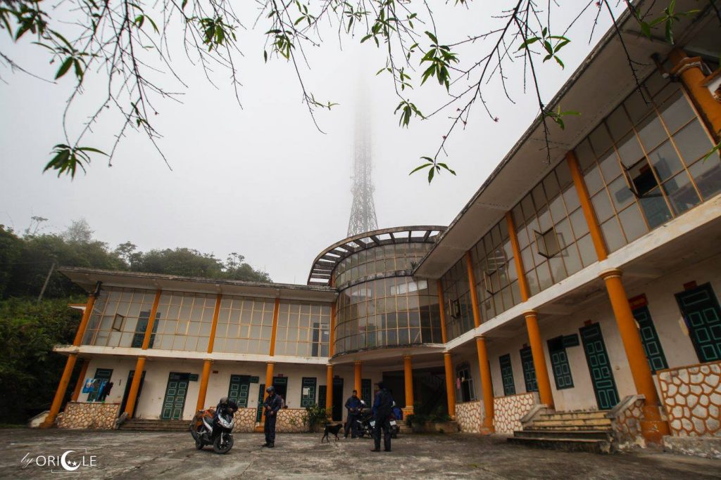
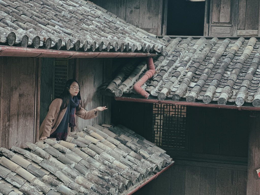
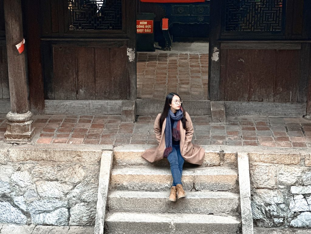
+ 5:00pm move to Hmong Kings‘ Palace also known as Dinh Vua Meo. This place is very beautiful so it takes a lot of time to visit and take photos. Entrance ticket is 20.000VND/person.
the H’mong King Palace, also known as the Vuong family’s mansion or the Meo King’s Palace, stands as a testament to the rich cultural heritage of the H’mong people. Located in a valley in Sa Phin commune, Dong Van district, Ha Giang. The entire Meo King mansion has an area of nearly 3,000 m2, started in 1898 and completed 9 years later, i.e. 1907.
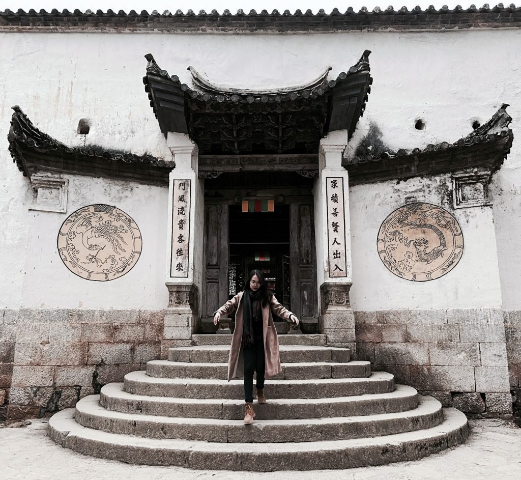
Construction began in 1898 and was officially completed in 1907, costing a huge sum of 150,000 Indochina white silver coins, equivalent to 150 billion VND today. The mansion was designed and built by Chinese Yunnan workers in conjunction with Mong ethnic people, creating a project larger than 1200m2 on an area of about 3000m2. Thanks to its long history and indisputable cultural value,
The architecture inside the mansion is extremely unique, the crystallization of three different cultures including the H’Mong, the French and the Chinese. Despite the combination of three cultures in architecture, many people commented that the Vuong family’s mansion is extremely harmonious, flexible and rhythmic as if forming a unified block without being restrictive or forced.
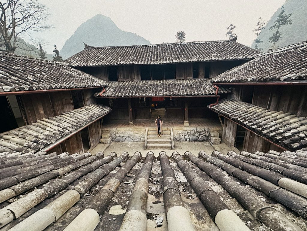
H’mong King’s Palace was ranked a national monument by the Ministry of Culture, Sports and Tourism in 1993, after nearly a century of existence. In addition, this mansion also took up to 5 years to start construction because it was all built with human power and did not use any mechanical means.
Hmong Kings‘ Palace also known as Dinh Vua Meo is an interesting destination in a Ha Giang of wonderful nature with pristine mountains and forests and poetic and rich scenery.
+ 6pm: move to Lo Lo Chai village in Lung Cu commune because I booked a homestay here. The road was very dark, deserted and dense fog combined with the cold spring night made everyone shiver when checking in at the homestay. However, Lo Lo Chai is a place worth experiencing throughout your journey.
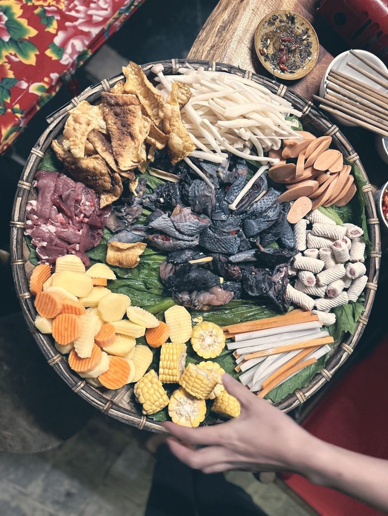
+ 7pm: check in homestay LoLo Acient Houses, take a shower with warm water and have dinner at the homestay. My recommendation for you is to eat black chicken hotpot, super delicious, it’s cold – eat hotpot – make some corn wine at Uncle Gai’s homestay owner (village head) when he cooks it “oh my god”.
** If you go with a group of 6-8 people, you should book a Dorm, the homestay is very nice, the bed and thick blankets are very warm. Traditional homestay of the Lo Lo people, and hearing about the culture of the people here is a wonderful thing. Homestay is fully equipped with hot and cold water, shampoo, shower gel… very convenient.
– Day 2: Lung Cu Flagpole-Lung Cu Border Guard Station (Ma Le place)-Dong Van Old Town-Ma Pi Leng Pass-Happy Road-Pa Vi H’Mong Village – Meo Vac Town:
+ Have breakfast & drink Northern Pole coffee, walk around Lo Lo Chai village and have beautiful photos.
Lo Lo Chai village (in Lung Cu commune, Dong Van district) is located close to the northernmost point of Vietnam, about 1.5 km from Lung Cu flagpole. Lo Lo Chai is a place that still retains many traditional cultural features with houses dating back many generations of the Lo Lo people.
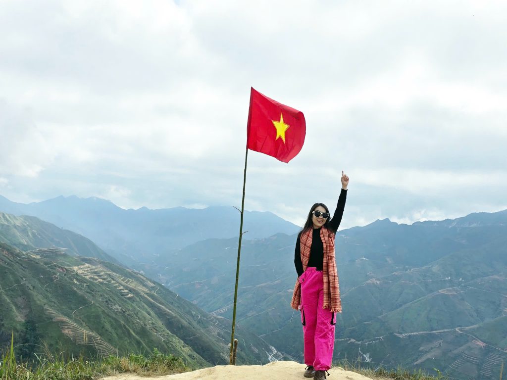
+ 9am: Go to Lung Cu Flagpole
Lung Cu flagpole, located at the northernmost tip of Vietnam, is an important symbol of sovereignty and a national historical relic. The flagpole at Lung Cu represents the connection between history and national spirit, and is a meaningful sacred destination for those who want to explore the beautiful Northeast region and rich in national cultural identity.
The name “Lung Cu” has many different explanations, but all are related to “Dragon”. There is an opinion that the correct name of this place could be “Long Co” (dragon-shaped drum) or “Long Cu” (where the dragon lives). However, there is an interesting theory that “Lung Cu” can be translated as “Dragon Valley”. In Cantonese “Lung” means Dragon, and “Owl” means Valley in Mandarin. With a landscape of mountains and valleys, “Dragon Valley” seems to be a suitable explanation for the name of this land.
+11 a.m.: Check out the homestay, move to Lung Cu border station in Ma Le to take photos of the “Tớ dày” (wild peach flowers), which are in beautiful blooming season.
When the weather turns cold, when the sakura flowers have not yet bloomed, the cherry blossoms in Ma Le commune bloom
+12:00: move to Dong Van old town for lunch. There are signposts along the way, so everyone should pay attention when turning, but if you go too far, the detour will be more than 20km away. ***Have lunch and coffee in the old town, then move to Meo Vac Town.
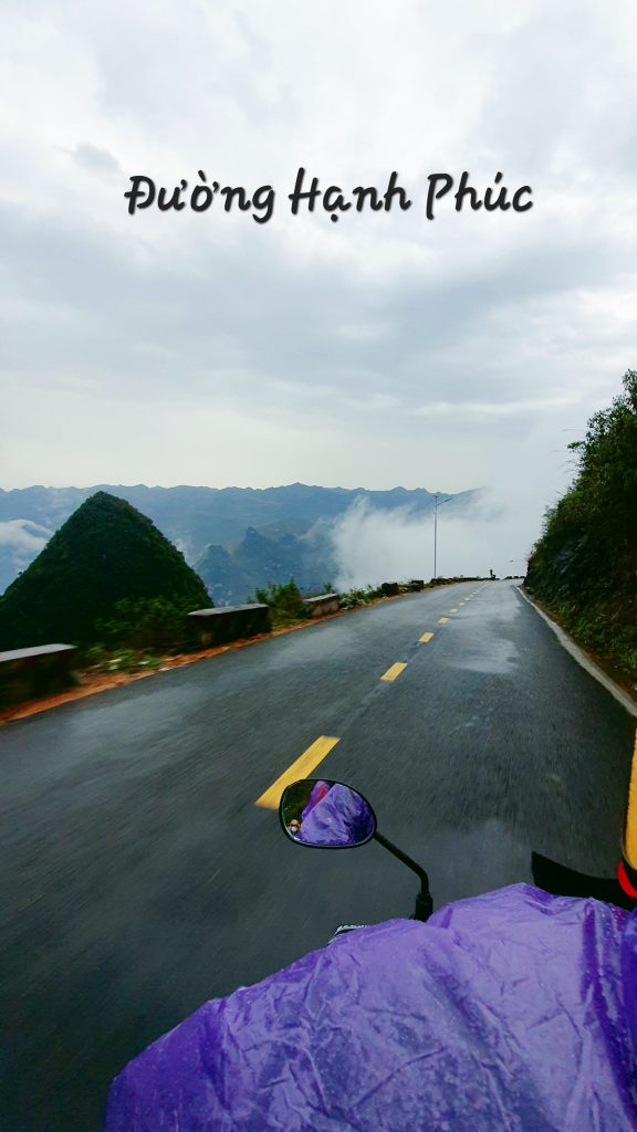
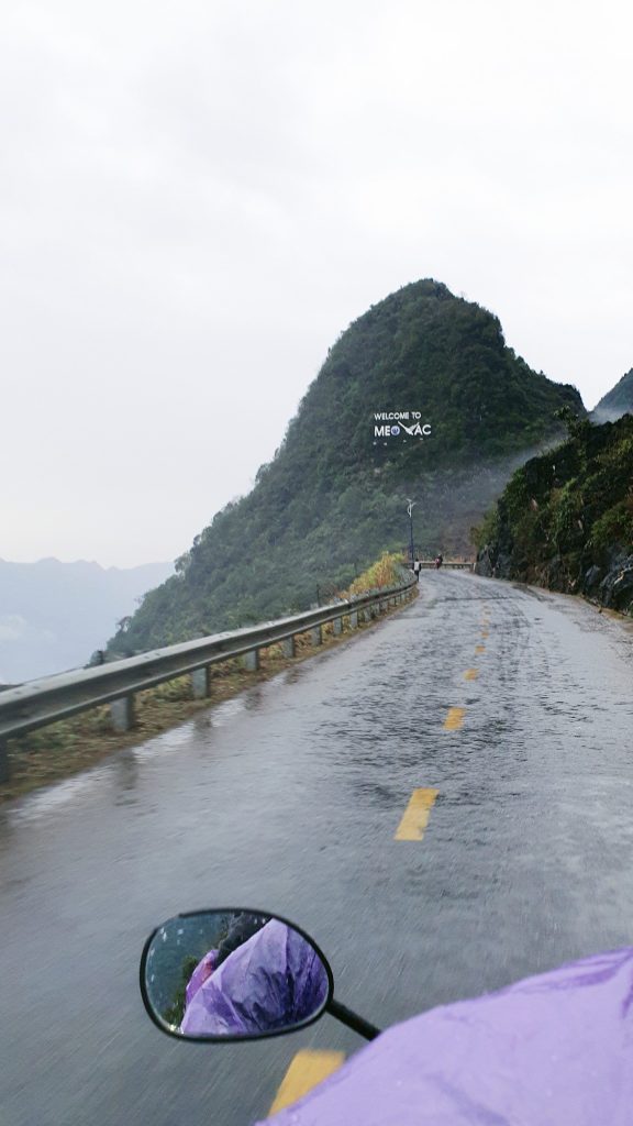
+ 3:00 pm: move to Meo Vac town, on the way will pass Ma Pi Leng pass and Nho Que River. You can stop to check in and take photos here. From above, experience the foggy downhill on the Happiness Road. Turn around into H’Mong village, Pa Vi hamlet and then go straight to Meo Vac town.
Ma Pi Leng Pass means “horse’s nose bridge”, known as the king of passes in the Northwest mountains, is a dangerous pass about 20km long, located in Pa Vi and Pai Lung communes, Meo Vac and Meo Vac districts. Ta Lung commune, Dong Van district.

Ma Pi Leng is known as one of the death passes of the Northern mountains, because of its dangerous curves that challenge the driver. The pass is located on Highway 4C, Pa Vi and Pai Lung communes, Meo Vac district, Ha Giang province, one of the highest and most dangerous slopes in the Northeast mountains, and is also on the list of “four great mountains”. “pass peak” of Vietnam is worth conquering. Located at an altitude of about 1,200m above sea level, and about 20km long (connecting Dong Van ancient town and Meo Vac town), Ma Pi Leng curves and wraps around the mountain like a white python. Following this road, you will pass through many villages or famous places such as Pa Vi, Sin Cai…
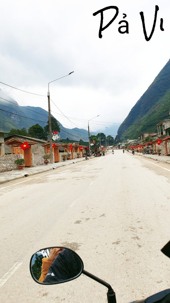
The way to Meo Vac town passes through Pa Vi village. The most impressive thing is that the houses here all have the same door. On the door hang a sign with the name of the householder and, most beautifully, hang the Vietnamese national flag.
+5:30 pm: check in to Thao Gia homestay. Take a shower, have dinner and rest
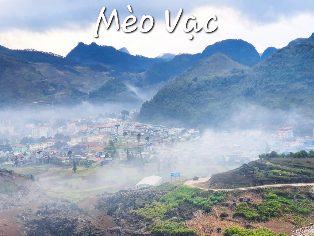
*** I did not choose Pa Vi H’mong village to stay because it is too touristy, very crowded, and expensive. Instead, run to Meo Vac town and stay at Thao Gia Homestay with a very beautiful view of the town. In the morning, Meo Vac is engulfed in mist, and at night, it is bright with colored lights. The homestay is extremely clean, many toilets, full hot and cold air conditioning. Enthusiastic service, affordable prices, spacious space.
– Day 3: Nho Que River – Meo Vac – M-shaped road – Mau Due commune – Du Gia commune:
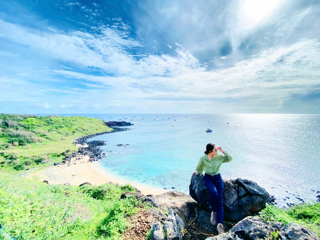
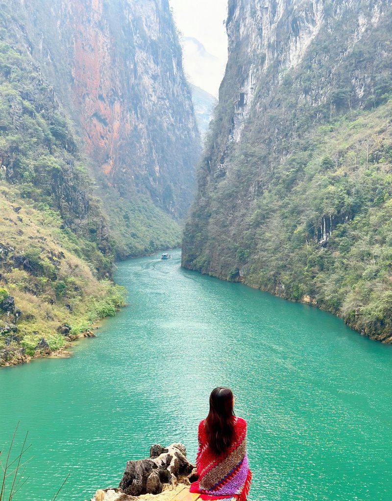
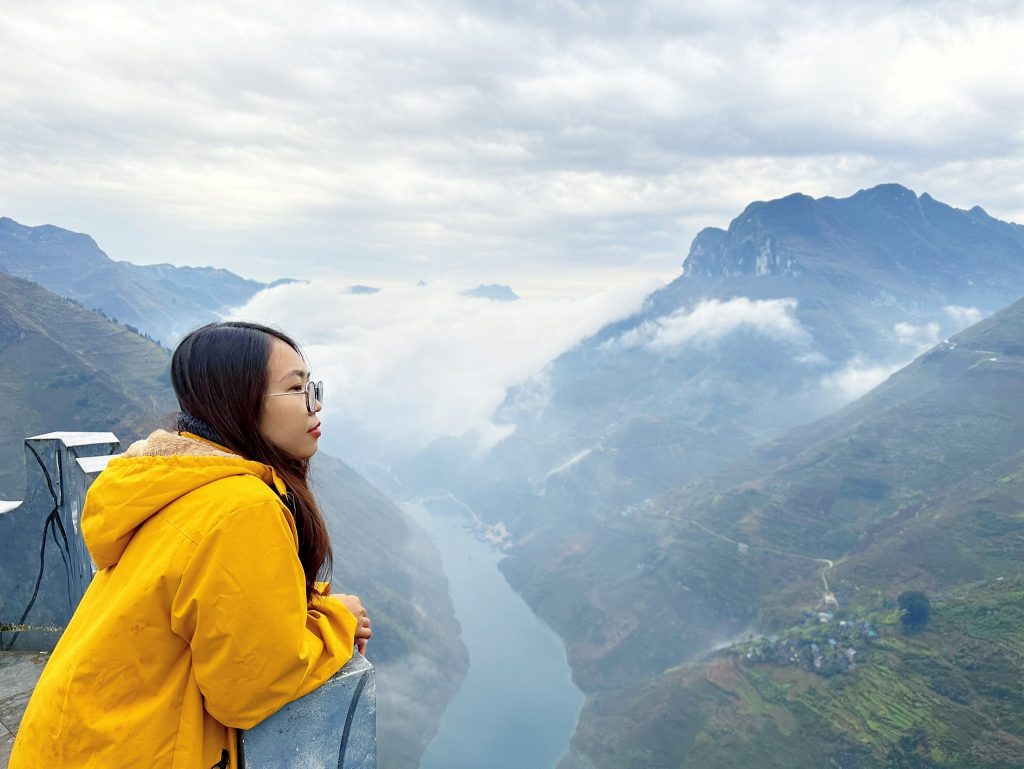
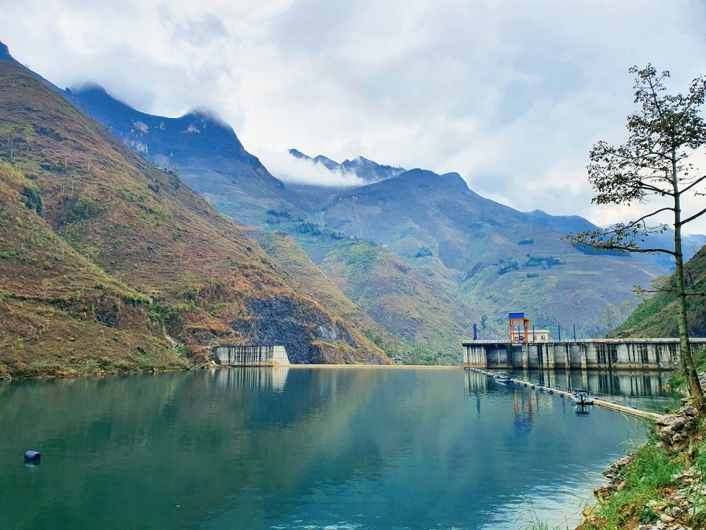
+ 8:00 am : go to Meo Vac town center to have breakfast then go straight to Nho Que river wharf. The road around is quite steep and a bit ugly, but in return the scenery is beautiful. ** Boat ticket is 120k/person, there is a shuttle bus to the boat wharf. Boat trip time is about 45 minutes. You can ask the boat driver to stop by the campsite for coffee to check in.
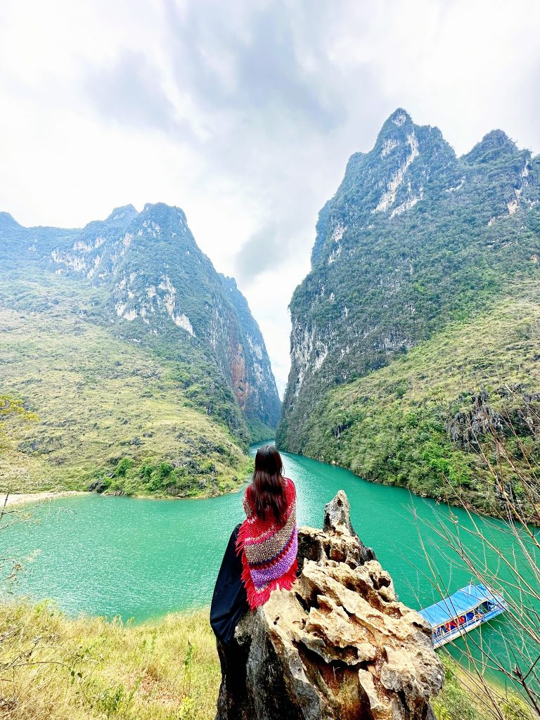
With a cliff height of up to 700m – 800m, a length of 1.7km, and a depth of nearly 1000m, Tu San Alley is considered a unique and magnificent landscape, the “first majestic” of the Dong Van stone plateau.
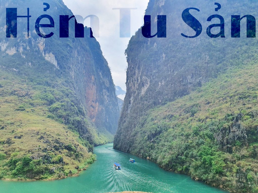
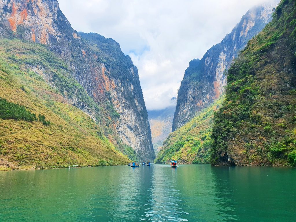
Originating from the 1,800m high Nghiem Son mountain (Yunnan, China), Nho Que River flows northwest – southeast, through wild and dangerous mountains and forests, pouring into Lung Cu commune (Dong Van, Ha Giang). to enter our country. The river continues downstream through the Tu San canyon, along Ma Pi Leng. When it reaches Meo Vac, it splits into two branches and flows to Cao Bang, finally joining the Gam river at the Na Mat junction.
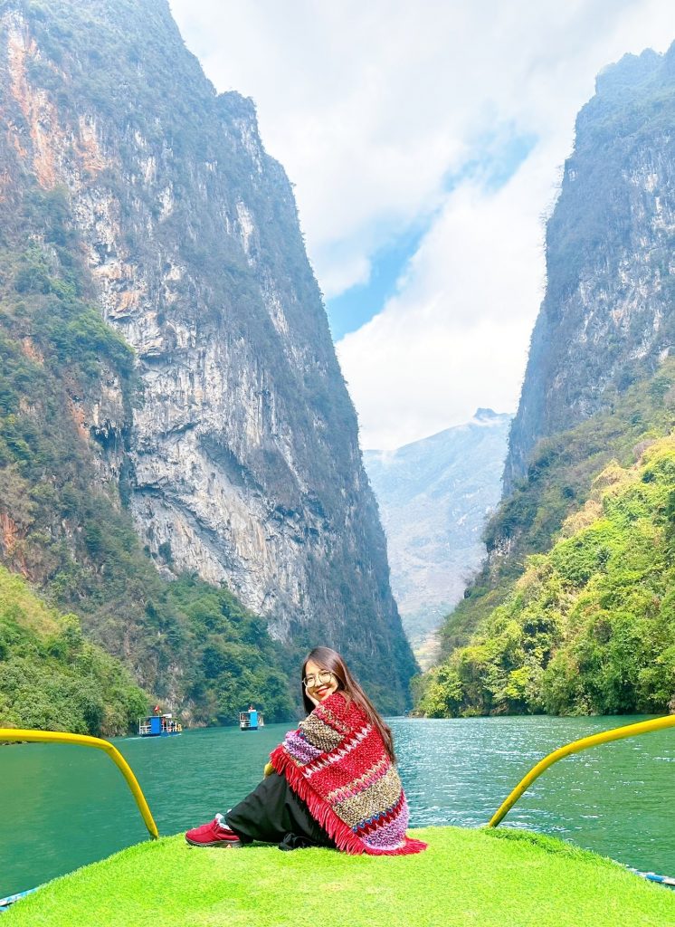
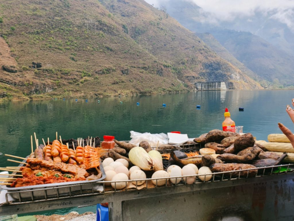
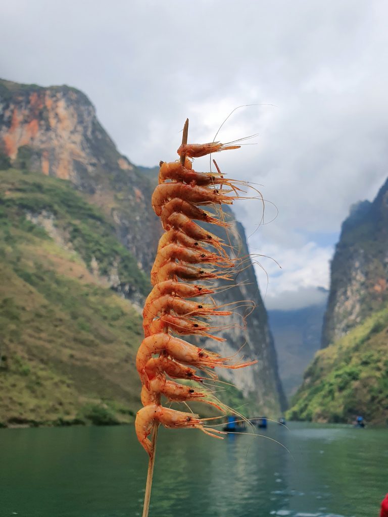
Most of the year, the water of the Nho Que River is a beautiful emerald green, shining between the cold gray rocky foothills, next to the dark green patches in the majestic space of old forests, mountain rocks and clouds. . +12:00: Have lunch at the marina: you should try river shrimp here, quite delicious, affordable price. If you want lunch, order it before the boat leaves the wharf, and when you return, you will have lunch. There are costumes for rent right at the boat dock, and along the way there are street vendors, so people can buy them and get on the boat while admiring the scenery and eating. Remember not to throw trash into the river.
+ 2pm: check out homestay, move back to Du Gia => The road from Meo Vac to Du Gia is quite bad. Because the road is being built, the gravel is bumpy. If it rains, it will be very muddy, slippery and easy to fall. In addition, there are easily landslides and fog. You should carefully consider the weather to choose a suitable travel schedule. We were lucky that it rained the night before but the next day it was sunny so the road was quite dry.
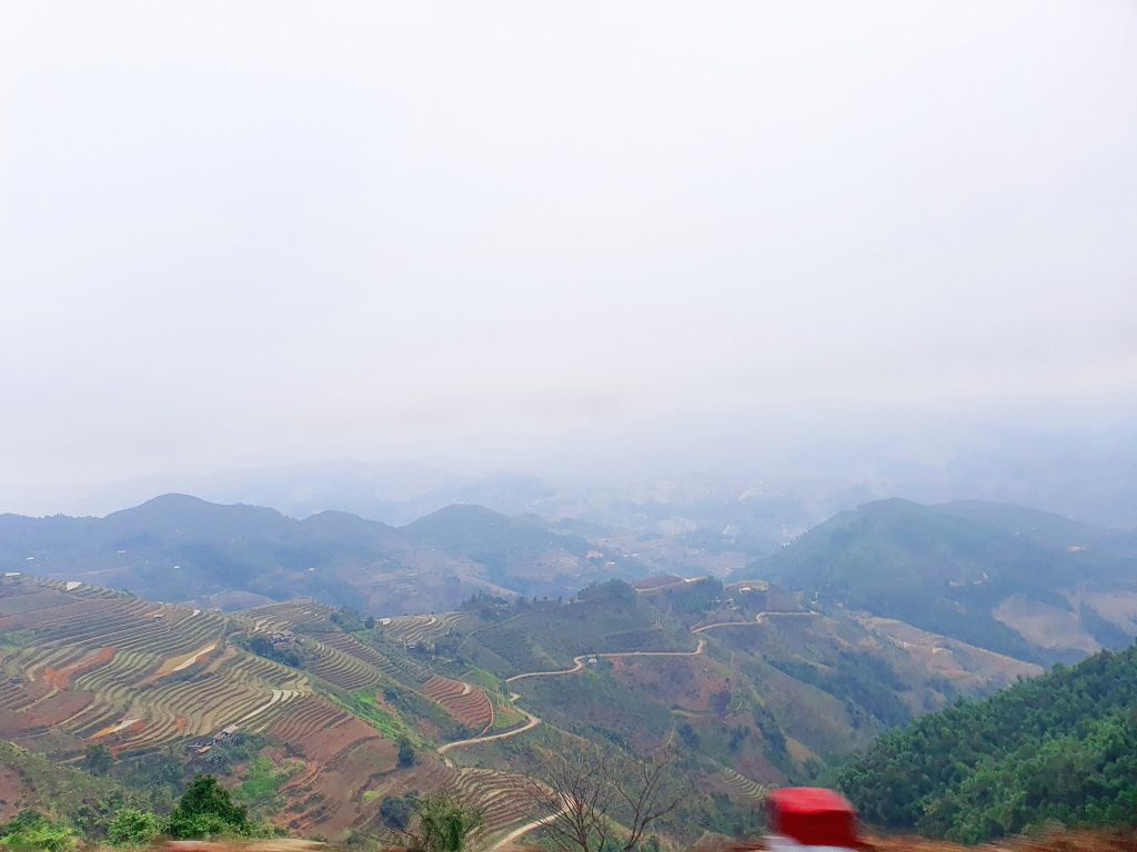
The road is extremely bad but the scenery on both sides is unreal, to compensate for the hardship of the traveler
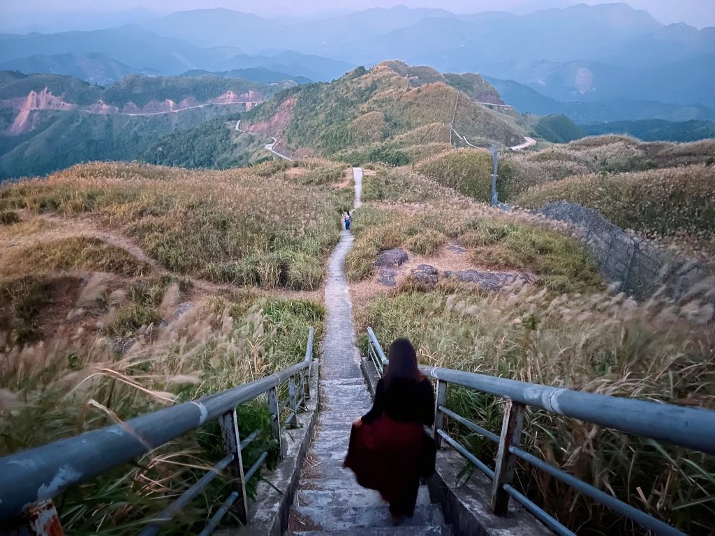
=> On the way, stop to rest a bit at the M-shaped road. Here, people are also building a rest stop. It is expected that in the future there will be a place to check in for everyone to park their cars and rest and have coffee.
=> The road to Du Gia is very beautiful, especially the section from Mau Due to Du Gia. This road when traveling in March during Bombax ceiba flower season is always brilliantly red.
+ 6pm: check in Hoi homestay, shower, have dinner, chill with corn wine and hot pot, then enjoy karaoke with foreign tourists, sit and listen to stories from H’mong and Tay ethnic groups. Their culture is beyond amazing.
– Day 4: Du Gia – Ha Giang city – Hanoi – HCM city:
+ Have breakfast at the homestay with egg noodles or banana crepes, sip a cup of coffee and watch the clouds drifting slowly in the Du Gia valley, inhaling the breath of nature free of dust and smoke. Walk around the village to see the white peach blossoms blooming, and chat with H’Mong girls harvesting corn. Feeling like the chaos outside stops at Du Gia.
Du Gia is a highland commune in Yen Minh district, about 70 km from Ha Giang city. On the tourist map of Ha Giang, Du Gia appears with a wild picture, not known to many Vietnamese tourists. Most visitors to Du Gia are backpacking enthusiasts who like to conquer adventurous mountain passes…
Du Gia appears like a picture with four mountain sides, stretching corn fields and winding streams…
=> There are also waterfalls in Du Gia. Western tourists love to bathe, but because the weather was quite cold and time was limited, we checked out of the hotel and moved to Ha Giang city.
+11:30 pm: Have lunch in Ha Giang city, stop by Ha Giang Market to buy some specialties and then return the car to Giang Son garage.
+2pm: on the Bang Phan bus back to Hanoi. The car picks you up at Giang Son motorbike rental location so it’s very convenient
+8pm: car returns to Noi Bai airport lobby, has dinner and then flies back to HCM. End of a nice, memorable journey
A FEW NOTES FOR EVERYONE: – Clothing: Check the weather forecast before going, and bring warm clothes because the weather in Ha Giang changes quite erratically, especially in the mountains, it is much colder than in the plains. You should wear sneakers for comfort because the attractions in Ha Giang are close together and require a lot of walking – Medicine: You need to bring insect spray, anti-sickness medicine (if traveling by car), headache medicine, stomach ache medicine, bandages… to make the trip safer. – Documents and luggage: You should bring your citizen identification card/ID card to show your place of stay – especially near the border. To rent a motorbike, you must definitely bring both your ID card and driver’s license. And whenever you see a gas station, you must fill up the tank to avoid walking in the middle of the road.
– When entering the village or local people’s house:
+ If there are “green leaves” or “marker stakes” on the road, you should not enter. Because the villagers (or homeowners) are avoiding strangers coming.
+You should avoid whistling when walking in the village because whistling will mean calling demons and storms to harass the people in the village.
+Do not pat children’s heads because they believe that doing so can make children sick.
Hopefully the above sharing will help everyone have a wonderful and memorable trip to“The land where flowers bloom on rocks”
P.s: I will post detailed articles about Lo Lo Chai, King Meo Palace, and Du Gia for everyone to refer to.

#hà_giang #full review #hagiangvietnam #phuothagiang #dulichhagiangtutuc #meovac #sủng_là #dongvanhagiang #Lolochai #travelvietnam #travelhagiang #Hagiangloop #Hagiangmotorbike #MeoVacTown #Pao’shouse #Hmongkingpalace #Vietnamtravel #travelblogger #dongvanplateu